Castle Rock Badlands Fossil Hunting Guide
Image: Flickr user 33134456@N04
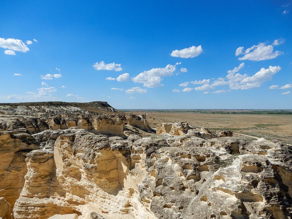
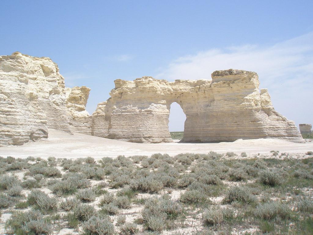
Castle Rock is a 70-foot chalk pillar in Gove County, western Kansas, carved by erosion from the Smoky Hill Chalk Member of the Niobrara Formation — the same Late Cretaceous chalk that produced the world-famous mosasaurs, plesiosaurs, and pterosaurs of the Western Interior Seaway. The pillar and the surrounding badlands sit on private land informally open to daytime visitors. Climbing is discouraged and the rock is fragile.
Castle Rock is a roughly 70-foot-tall chalk pillar standing alone on the High Plains of Gove County in western Kansas, surrounded by a small but spectacular field of chalk badlands sculpted by erosion. It is one of the recognised "8 Wonders of Kansas" geological landmarks, alongside its better-known neighbour Monument Rocks, about 20 miles to the southwest. Castle Rock is carved from the Smoky Hill Chalk Member of the Niobrara Formation, the Upper Cretaceous chalk deposit that records the open shelf of the Western Interior Seaway during the high-stand interval between roughly 87 and 82 million years ago. The same chalk member, in nearby exposures, produced the world's most famous mosasaur, plesiosaur, pterosaur, and giant-fish faunas from the late-19th-century bone wars of Cope and Marsh through to the modern collections at the Sternberg Museum of Natural History in Hays.
Castle Rock itself sits on private land. The owners have historically allowed daytime public visits at the visitor's own risk, with no marked trails, no fees, and minimal infrastructure. The rock is fragile and erosion has visibly accelerated where visitors have climbed; vertebrate fossils at Castle Rock are uncommon, but the geological and landscape experience is the main draw.
This guide covers the visitor logistics, what casual fossils you might see, and the broader Niobrara context that makes the chalk famous.
Location and Directions
Castle Rock is about 15 miles south of Interstate 70 in Gove County, western Kansas. The standard route is to take I-70 to the Quinter exit (Exit 107, Castle Rock Road), turn south, and drive about 15 miles to the intersection with Gove County roads 80 and K, then turn east for about 4 miles to a small signed pull-off and cattle guard. From the cattle guard a short dirt track leads to the pillar and badlands.
Travel notes: the access road is unpaved and impassable in wet weather. There is no water, no shade, no toilet, no fee booth, and no staff at the site. Cellular reception is intermittent. Daytime visits only; rattlesnakes are present in summer. Bring footwear with ankle support — the chalk surface is loose and the badland slopes are steep in places.
What Fossils You'll Find
Castle Rock is part of the Smoky Hill Chalk Member of the Niobrara Formation, a roughly 200-metre-thick succession of chalk and chalky shale that records pelagic sedimentation in the broad, warm Western Interior Seaway between about 87 and 82 million years ago. The dominant rock-forming organisms in the chalk were calcareous nannoplankton (coccoliths) and planktonic foraminifera, microscopic fossils that make up the bulk of the rock itself. Macroscopic fossils are uncommon at any single point in the chalk but locally spectacular when present.
What a casual visitor at Castle Rock is most likely to see, picked up loose at the foot of the pillar or weathered out of the surrounding badlands, is the giant clam Inoceramus — large, paper-thin, often disarticulated bivalve shells whose prismatic calcite structure makes them easy to recognise. Foraminifera and tiny invertebrate debris are present throughout the chalk but require a hand lens to enjoy. Vertebrate fossils at Castle Rock specifically are not common: the world-famous mosasaurs (Tylosaurus, Platecarpus), plesiosaurs (Elasmosaurus, Styxosaurus), pterosaurs (Pteranodon), giant fish (Xiphactinus), turtles (Protostega), and sharks (Squalicorax, Cretoxyrhina) of the Smoky Hill Chalk are documented from many locations across western Kansas, but most of those discoveries come from the deeper badland exposures around Logan, Trego, and southwest Gove counties rather than from Castle Rock itself. A keen-eyed visitor at Castle Rock occasionally finds a shark tooth, a fish vertebra, or a fragment of mosasaur bone weathered out of the chalk, but these are uncommon and require careful identification.
Most importantly: the rock owner does not permit digging into the pillar or the badland faces. Surface finds in the loose rubble are at the property owner's discretion.
"In 2001 the top of Castle Rock's tallest spire toppled after a thunderstorm" — lopping about ten feet off the pillar's overall height. Wikipedia summary citing local reporting on the collapse
Geologic History
During the Late Cretaceous, what is now Kansas lay near the centre of the Western Interior Seaway, an inland sea that connected the Arctic Ocean with the Gulf of Mexico across the heart of North America for tens of millions of years. The seaway reached its maximum extent around 90 million years ago and progressively shallowed through the latest Cretaceous as the early Laramide orogeny began to uplift the Rocky Mountains and shed clastic sediment eastward into the western part of the basin. The Smoky Hill Chalk Member records a relatively quiet interval in the seaway's middle history, between about 87 and 82 million years ago, during which the open shelf was far from any major siliciclastic source and slowly accumulated calcareous plankton-derived ooze in deep, oxygen-poor bottom waters.
Castle Rock and the surrounding badlands are the result of erosion of the Smoky Hill Chalk on the modern High Plains. The pillar's distinctive shape is preserved because a slightly harder caprock retards erosion at the top, while the softer chalk below weathers back faster, leaving the column standing. The chalk is genuinely fragile: in 2001 the top of the tallest spire toppled after a thunderstorm and the pillar lost roughly ten feet of overall height. Continued erosion will eventually destroy the pillar entirely.
How Castle Rock became a landmark
Castle Rock served as a navigational landmark for Indigenous travellers and for the Butterfield Overland Despatch stagecoach line that ran the Smoky Hill Trail across western Kansas from 1865 onwards. Fossil collectors began working the surrounding Niobrara badlands from the 1870s onwards, most famously the Sternberg family of Kansas, who supplied specimens to museums across the United States and Europe for more than a century. Castle Rock itself is now privately owned and the visitor experience is informal.
Collecting Rules & Regulations
Is Fossil Collecting Allowed?
Surface collecting is at the property owner's discretion and should not be assumed. Digging into the pillar or badland faces is not permitted. Climbing the formations is discouraged.
Key Points:
- Private land, daytime visits only, no fees, no facilities.
- Stay on the unpaved access track during wet weather; it is impassable when muddy.
- Climbing or scrambling on the pillar is discouraged because of accelerating erosion.
- Surface finds in the loose rubble are at the property owner's discretion; ask if you can.
- For substantive Niobrara collecting, work with the Sternberg Museum or a licensed local guide.
Sources
Nearby sites
 Monument Rocks (Chalk Pyramids) Fossil GuideMosasaurs, Giant clams (Inoceramus)
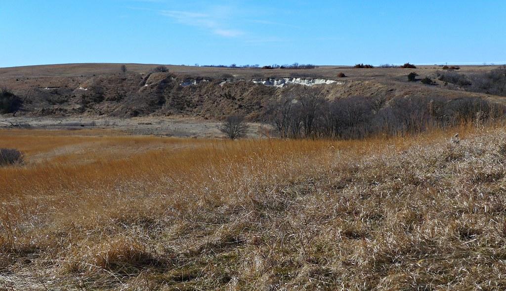 Ashfall Fossil Beds State Historical Park Fossil Hunting GuideTeleoceras major (barrel-bodied rhinos), Cormohipparion occidentale (three-toed horses)
 Garden Park Fossil Area Fossil Hunting GuideAllosaurus fragilis (type), Stegosaurus stenops (type)
 Dinosaur Ridge: Dinosaur TrackwaysDinosaur Tracks, Dinosaur Bones