John Muir National Historic Site Fossil Hunting Guide
Image: NPS (Public domain)
The John Muir National Historic Site preserves the home and orchards of John Muir in the city of Martinez, California, on the southern shore of Carquinez.
The John Muir National Historic Site preserves the home and orchards of John Muir in the city of Martinez, California, on the southern shore of Carquinez Strait. The property is best known as the place where Muir wrote much of his later conservation work, but the 345-acre site also includes Mt. Wanda, a hill of folded marine sedimentary rock that belongs to the Great Valley Sequence. The bedrock at Mt. Wanda is part of a thick Cretaceous-to-Paleogene marine package that produces sparse but real fossils elsewhere along the East Bay hills, including small bivalves, ammonite fragments, and trace fossils. At the John Muir site itself, fossils are uncommon at the surface, the trails are the only access, and collecting is prohibited under National Park Service regulations. This guide is honest about that limitation. It is included on this list because Muir's home is a productive day trip for visitors who want to understand the geological setting that shaped his later writing on Yosemite and the Sierra Nevada, with the realistic expectation that this is a geology-walking visit rather than a fossil-hunting one.
Location and Directions
The John Muir National Historic Site is at 4202 Alhambra Avenue in Martinez, Contra Costa County, California.
From Interstate 4, take the Alhambra Avenue exit and drive south. The site entrance is on the west side of Alhambra Avenue, about a quarter mile south of the freeway. There is a small free visitor parking lot in front of the visitor center.
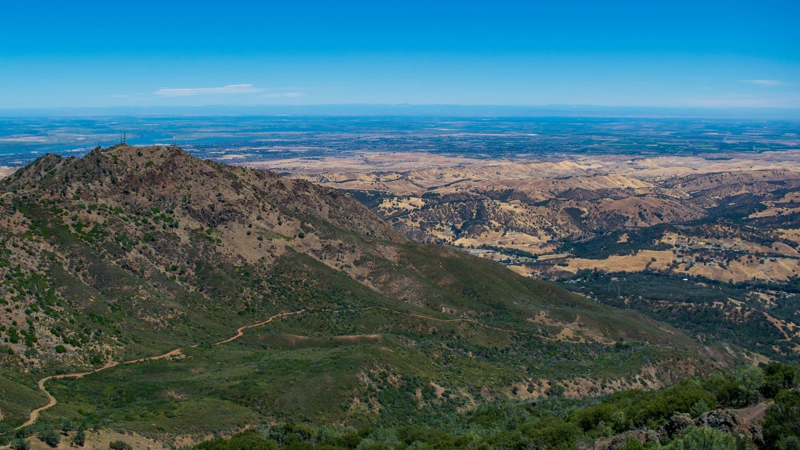
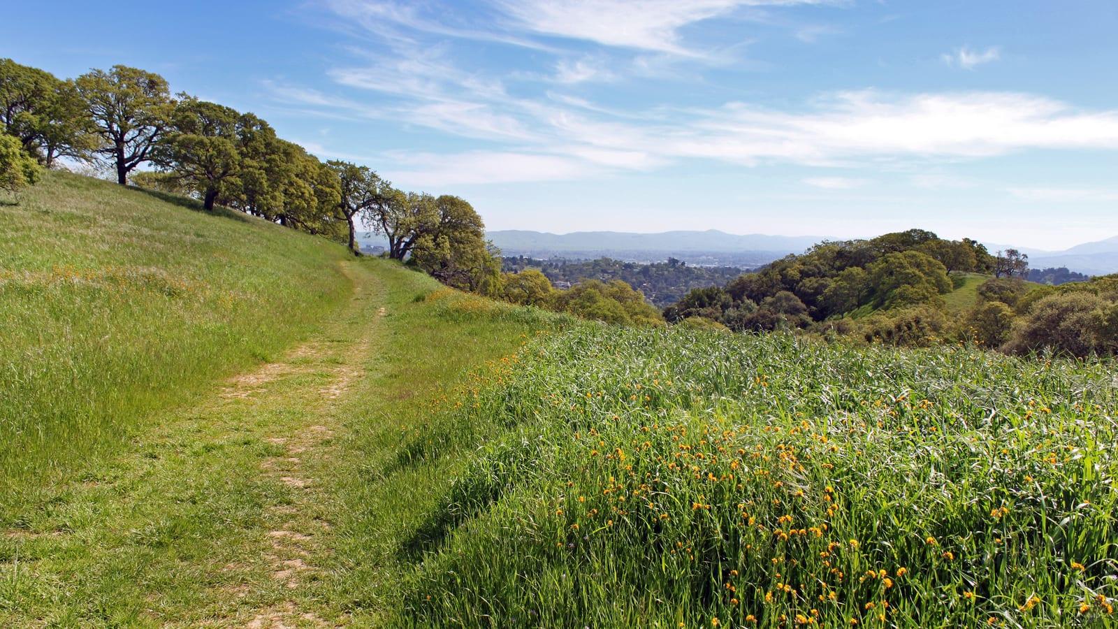
The Muir House and orchards are on the flat ground east of Alhambra Avenue. Mt. Wanda, the geologically interesting half of the site, rises west of Alhambra Avenue and is reached by an unpaved trailhead on the opposite side of the road from the visitor center. A pedestrian crossing leads from the lot to the trailhead. Trails on Mt. Wanda climb roughly 660 vertical feet to a series of summit ridges with views over Carquinez Strait and Mt. Diablo. The two main trails are the Nature Trail loop and the Fire Road, and together they cover about three miles of moderate hiking through grassland and oak woodland.
The site is open Wednesday through Sunday for the historic buildings; the trails on Mt. Wanda are open daily from sunrise to sunset. Admission to the historic buildings is free. The trails have no facilities, no shade through most of their length, and no water; bring your own. Summers are hot and grass-fire risk is high; the site closes the trails during high-risk fire weather.
What Fossils You'll Find
Fossils on the site are uncommon and the locality is best understood as a place to see Great Valley Sequence rock in outcrop rather than a place to find specimens. With patience and on freshly weathered surfaces, the following finds are possible.
Marine bivalves, including small clams of the inoceramid group, are the most likely fossil. They appear as flat, elongate shell impressions on bedding planes in the dark mudstone exposures along the upper Mt. Wanda fire road. Most are fragmentary and partly recrystallized.
Ammonite fragments have been recovered elsewhere along the East Bay hills from the same stratigraphic level and may occur on Mt. Wanda. Look for curved, ribbed shell sections in concretions or in mudstone interbeds. Complete specimens are rare and have not been documented at the site itself.
Trace fossils, especially horizontal feeding burrows, occasionally appear on cleaved bedding surfaces. They are easier to spot than body fossils because they show as raised relief on the rock face.
The most productive approach at the John Muir site is not to hunt actively but to study fresh exposures along the fire road cuts after winter rains, when slumping has revealed unweathered rock, and to recognize the rock type itself as a record of a deep marine basin.
Geologic History
Mt. Wanda is built of the Great Valley Sequence, a thick package of marine sedimentary rocks deposited from the Late Jurassic through the Eocene, roughly 145 to 50 million years ago, in the forearc basin between the Franciscan subduction complex to the west and the rising Sierran arc to the east. The rocks at Mt. Wanda are predominantly the Cretaceous portion of the section, with Paleogene units potentially capping the upper exposures.
Lithologically the section is dominated by dark marine shale and mudstone with subordinate sandstone and occasional concretion-bearing horizons. Deposition was in deep water on the floor of the forearc basin, with periodic input of sand by turbidity currents flowing off the continental shelf. The fossils preserved in the sequence are accordingly a deeper-water marine fauna of bivalves, scattered ammonites, and trace-fossil-making infauna rather than the shallow-shelf clams and oysters that fill younger units in the East Bay.
After Eocene time, deposition ended at this site as the Sierran arc and Coast Ranges began to consolidate. The modern hills around Carquinez Strait took their present shape over the past few million years, raised and tilted by compression along the Calaveras and other strike-slip faults of the East Bay system. Erosion is now stripping the section, and Carquinez Strait itself is the drowned mouth of the ancestral Sacramento and San Joaquin rivers, cut through the rising hills during the Pleistocene.
The geological story of the John Muir site is, in this sense, the same story as Mt. Diablo less than 15 miles to the southeast, told in a smaller and less dramatic exposure.
How John Muir National Historic Site Became a Fossil Viewing Site
The site was never developed for fossil collecting. The grounds and orchards were Muir's working farm from 1890 until his death in 1914, and the National Park Service acquired the property in 1964 to preserve it as a memorial to his conservation work. The Mt. Wanda parcel was added in 1992 to protect the open space behind the house. Fossils are not the point of the site; they are an incidental feature of the bedrock that happens to be exposed along the trails.
The reason the site appears in fossil-locality guides at all is the Geologic Resources Inventory program of the National Park Service, which in its 2017 inventory report for the site documented the underlying Great Valley Sequence and the sparse fossil content reported in the regional literature. That inventory is the basis on which Mt. Wanda's outcrops can be discussed geologically; it is not a collecting permit.
Collecting Rules and Regulations
Collecting is not permitted. The John Muir National Historic Site is a unit of the National Park System, and 36 CFR 2.1 prohibits the possession, destruction, removal, or disturbance of any natural feature, including rocks, minerals, and fossils, in any National Park Service unit. This is a viewing-only and photography-only locality.
Practical rules and warnings:
- Examine fossils where you find them. Photograph them in place rather than collecting.
- Stay on designated trails. The Mt. Wanda hillsides are working ranch grassland with rattlesnakes, and the fire risk in summer is high.
- Trails close in extreme fire-weather conditions. Check the National Park Service site alerts before driving over.
- The historic buildings are open Wednesday through Sunday. The trails are open daily from sunrise to sunset.
- Admission to the visitor center, house, and trails is free; there is no parking fee.
- Dogs are allowed on Mt. Wanda trails on leash but are not allowed inside the historic buildings.
- Cell coverage on Mt. Wanda is good but drops in the wooded ravines on the south side.
Sources
- National Park Service, "John Muir National Historic Site." https://www.nps.gov/jomu/index.htm
- National Park Service, "New Geologic Resources Inventory Report Available for John Muir National Historic Site." https://www.nps.gov/articles/000/new-geologic-resources-inventory-report-available-for-john-muir-national-historic-site.htm
- 36 CFR 2.1, "Preservation of Natural, Cultural and Archeological Resources." https://www.ecfr.gov/current/title-36/chapter-I/part-2
- California Geological Survey, "Geology of the San Francisco Bay Region." https://www.conservation.ca.gov/cgs